Maryland Mesonet Near Real-Time Temperatures Dashboard
Surface observation mapping suite across Maryland, including wind chill and excessive heat conditions.
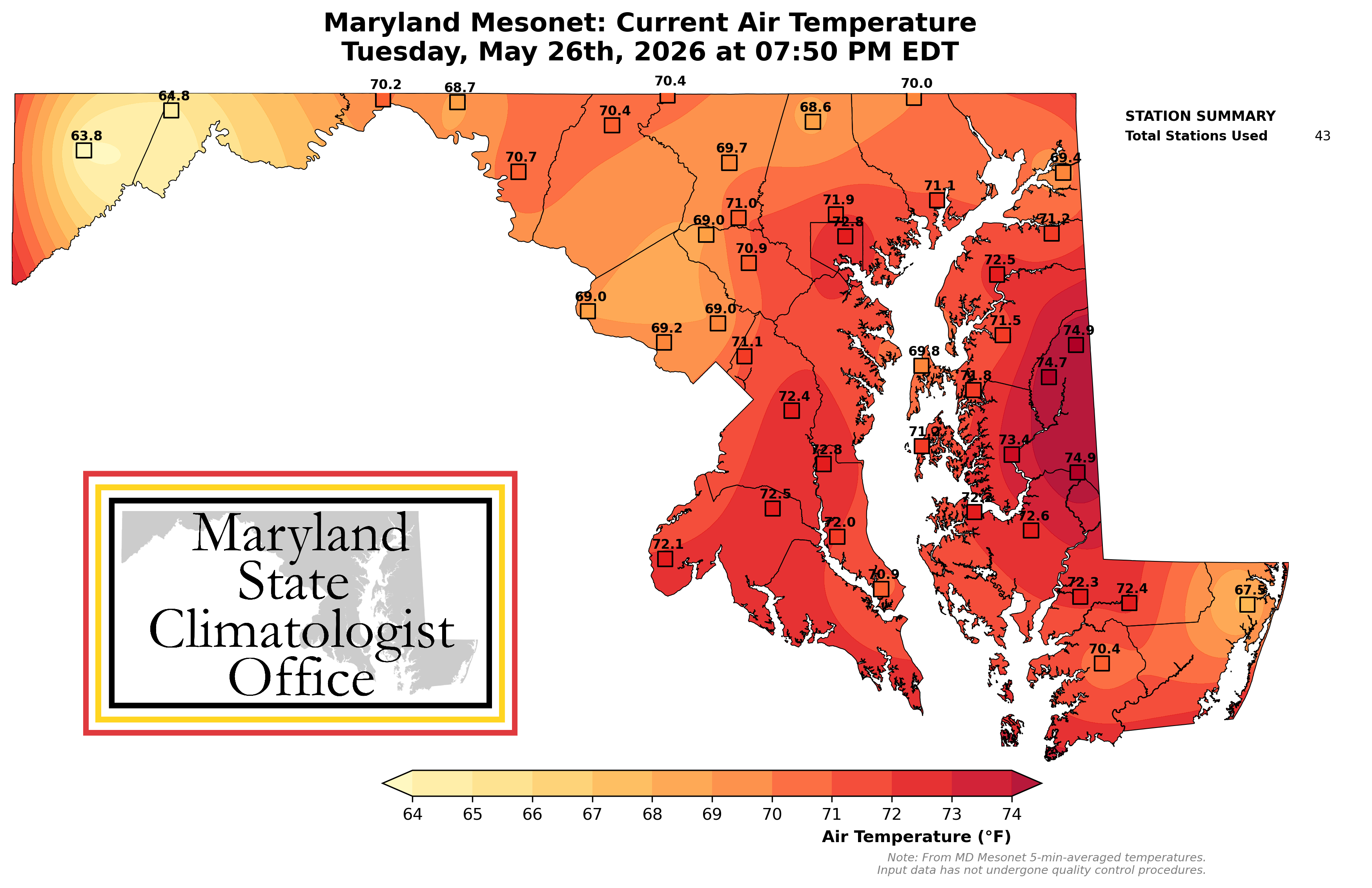
Current Surface Air Temperature (°F)
Map updates automatically every 15 minutes.
Wind Chill Monitoring
& Cold Hazards
Track real-time regional wind chill thresholds, winter frost risks, and severe cold spells across the state mesonet array.
- Live Wind Chill Threshold Maps
- Frost/Freeze Risk Levels
Heat Index Monitoring
& Heat Stress
Monitor real-time high-temperature heat indices, localized humidity heat stress risk bands, and agricultural heat indexes.
- Live Apparent Temperature Heat Index Maps
- Excessive Heat Risk Levels